
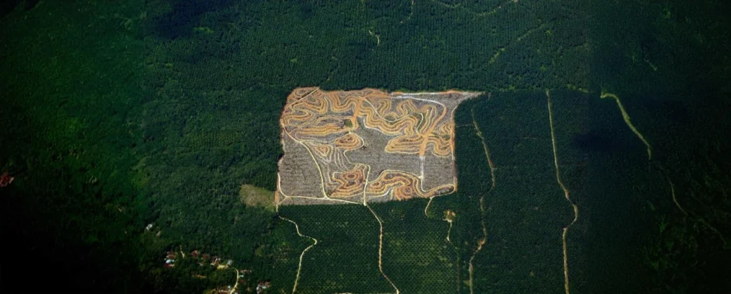
Topographical maps, also called topo sheets, contour maps or elevation maps. During your house planning, you need to consider the contour details of the land. Builders and designers give importance to topographical surveys and consider topographical maps to design and construct the house effectively.
Read today’s Brick & Bolt blog to learn more about topographical mapping.
What is a Topographical Map?
A topographical map is a thorough representation of the surrounding area where you will be going to build your house. This map will detail terrain along with various natural and man-made features. All this will be indicated with contour lines to connect points of equal height; this can give exact details like gradient and landforms. Thus, it’s generally called contour maps.
This topographical map is useful for engineering, architecture, environmental planning, and construction projects.
Why Are Topographical Mappings Essential for House Construction?
Before starting any construction project, you need to study contour maps. As they help to
To Understand Terrain & Elevations:
Topographical maps will give a detailed idea about the land terrain’s shape, slope, and elevation. Architects and builders need to understand these details to create building designs and site analyses, helping them make informed decisions about land use and construction practices.
Evaluating Slope Gradients:
With the help of these elevation maps, you can easily evaluate slope gradients of the area where you’ll construct your house. It will help to determine the stability of the site. A detailed study of these gradients allows you to prevent issues related to soil erosion and foundation instability that can be seen on steep or uneven ground.
Assessing Drainage Patterns:
Topo maps help study drainage patterns to ensure water flows away from the foundation and reduces the risk of flooding. By recognising potential areas of water accumulation, builders can design suitable drainage solutions in their construction plans.
Compliance with Zoning Laws & Environmental Regulations:
Topographic maps play a crucial role in ensuring compliance with zoning laws and environmental regulations. They provide essential details on elevation, slopes, and watercourses, helping authorities assess land use and development. These maps also support sustainable planning by identifying drainage patterns, flood zones, and natural habitats, aiding in environmental protection. Geographic Information Systems (GIS) integrate topographic data to visualise environmental constraints, facilitating informed decision-making.
How to Read and Interpret a Topographical Map
You need to read and understand topographical maps for your building projects to understand the terrain, ensure adherence to zoning laws, and plan sustainable development. Here’s a step-by-step guide:
Step 1: Understand the Map Basics
You need to understand specialised symbols and colours used on the contour map. They will use blue for water bodies, green for vegetation, black for boundaries, and grids and roads in red.
To read the topo maps properly and in proper alignment with the surroundings, make sure to use the consistent north-oriented placement of topographic maps at their top.
Step 2: Analyse Contour Lines
Contour lines indicate the elevation of the ground. A single contour line indicates the same height, ensuring no elevation change along its path. Therefore, they won’t intersect each other. The vertical interval is the distance between contour lines, which helps to determine the degree of steepness in an area. If more closely spaced contour lines are present, this indicates a steeper slope, whereas less frequently appearing contours indicate gentler terrain.
Step 3: Assess Environmental Factors
When you are analysing the land for building the house, consider
- Vegetation and Water Bodies: Identify the green areas and water bodies to plan around environmental constraints.
- Slope and Drainage: Understanding the slope helps prevent water drainage problems and soil erosion, making the land safer for building. Consider natural drainage patterns. A map depicting these features can inform decisions about where to site a foundation to avoid potential flooding.
How to Obtain Topographical Maps for Your Project
You can get the topographical maps for your house project through several sources.
- Government resources, such as the Survey of India, give official topo sheets with detailed land features.
- Geological surveys also create specialised maps for specific regions, accessible through their websites.
- For more precision, you can work with professional surveying services to get custom maps specialised for your project’s requirements.
Cost of Topographical Mapping in India
In India, the cost of topographical mapping can vary based on different factors, such as land size, terrain complexity, and geographic location. On average, topographical surveys can range between ₹10,000 to ₹15,000 for smaller areas, but prices can increase significantly for larger or more complex sites.
Topographical Mapping Tools and Software
Topographical mapping tools include a range of technologies and instruments to enhance the accuracy and efficiency of mapping projects. Advanced options like AutoCAD and GIS software facilitate precise design, spatial analysis, and data manipulation. Drones equipped with high-resolution cameras allow for rapid data collection, even in difficult terrains.
In addition to these digital tools, basic survey instruments are essential for gathering data to create detailed maps. Theodolites are used for measuring angles while leveling instruments—such as dumpy levels and tilting levels—help determine elevation. Measuring tapes provide accurate linear distances, and compasses assist in establishing direction.
While digital mapping tools enable the customisation of maps, DIY mapping has its limitations; it can encounter accuracy issues and often requires significant technical expertise. Professional mapping services offer expert accuracy but can be costly. Researching local service providers can help find budget-friendly options tailored to specific project requirements.
By integrating advanced technologies with traditional survey tools, you can achieve comprehensive mapping results that meet various needs—from construction projects to environmental studies.
Incorporating Topographical Data into House Design
You need to consider topographical data to design your house. You can work with architects and engineers to ensure the design complements the natural surroundings and the site’s landscape. By using cut-and-fill calculations, builders can considerably reduce earthwork, which reduces costs and lowers the environmental impact. You need to tactically position and orient the house based on the topo sheet to maximise natural light and views while enhancing energy efficiency. Also, designing a foundation that suits the land’s condition makes the house stable and long-lasting. Checking soil type and land height helps prevent sinking and other problems.
Common Mistakes to Avoid in Topographical Mapping
Ignoring Contours and Natural Slopes
Many contractors ignore the natural slope or topographical elevations of the land. It can cause improper grading, drainage issues, and increased construction costs due to unnecessary earthworks.
Misinterpreting Contour Intervals and Slope Gradients
It’s possible to misunderstand the contour intervals, which leads to misjudging slope gradients. This can affect the site levelling process and drainage planning, which can cause erosion or water accumulation. This will compromise the structural integrity of buildings and lead to environmental threats.
Disregarding Spot Levels and Relief Levels
Ignoring spot levels and relief levels can obscure small changes in elevation and landform variations. This mistake can cause design errors that affect where buildings are placed and how they fit into the landscape. Not paying attention to these details can lead to poor land use and higher costs for fixing problems during construction.
Inadequate Georeferencing
Proper georeferencing is important to align topographic maps properly. Errors in this process can create fake vertical changes, which can cause problems in planning and building. These errors can confuse architects and engineers about site conditions, leading to improper design decisions.
Incorrect Classification of Ground Points
If ground points are wrongly classified in digital terrain models (DTMs), the ground surface may not be shown correctly. This can be a huge problem near buildings where there are no ground points to guide the DTM. As a result, site analysis and planning can be inaccurate, which can cause building problems or harm the environment.
Neglecting Environmental Features
Ignoring natural features like rivers, streams, and trees can cause building problems. Not considering water bodies can lead to drainage issues, and removing vegetation can make the soil weak. Ignoring these features can lead to environmental degradation and increased construction costs due to unforeseen challenges.
Lack of Multiple Topographic Profiles
You can’t just create a single topographic profile and rely on that because it can be incomplete or inaccurate. You need to take multiple profiles to understand different elevation changes across the site. This will help to assess site suitability and guide design decisions. Insufficient profiling can result in poor building placement and inefficient site development.
When you are building your house near a mountain or elevated area, you need to assess and understand the site thoroughly. Topographical maps will help builders and designers to understand land elevations, slopes, and drainage patterns. Designing the house along with topographical data will help the construction projects to succeed well. For professional guidance on topographical mapping and house construction, you can consult experts like Brick & Bolt to make informed decisions for your project!